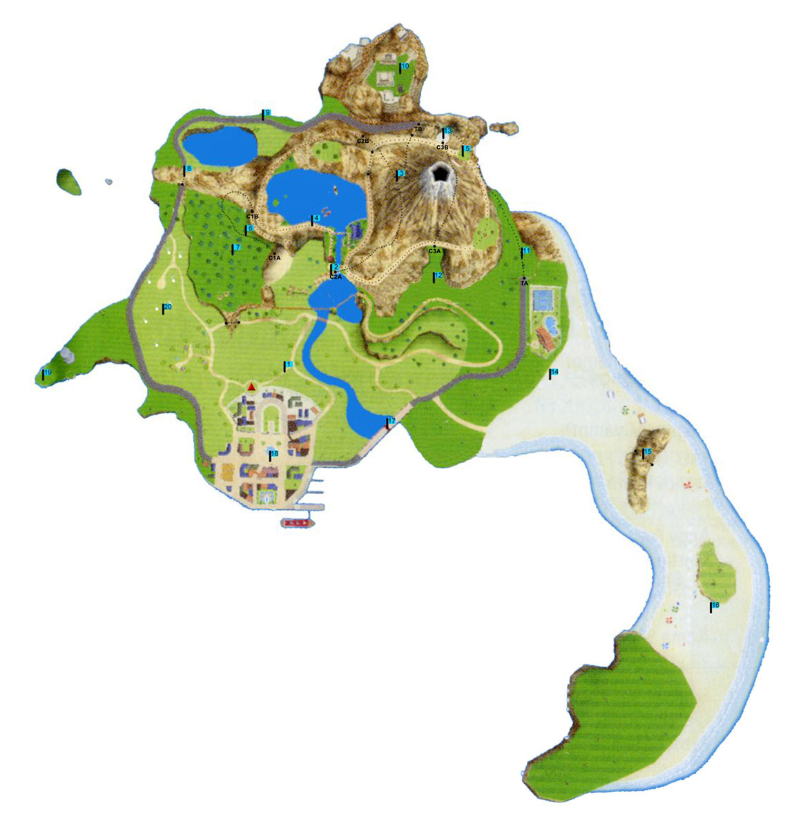
Measurements were made on a large file map using Photoshop CS5 Analysis feature.
The map image was 2700 x 2870 pixels and displayed as a 7.5 inches wide image in our monitor.
The Measurement Scale was set at 2700 pixels per 7.5 inches
We used the Ruler Tool for straight lines and the Polygonal Lasso to measure perimeters.
To determine the length of a curve we used the Polygonal Lasso for the curve areas and the Ruler Tool for the beginning and end of the curves.
The straight line from beginning to end was subtracted from the perimeter to obtain the length of the curve path.
All measurements were done in inches at the scale of 2700px/in
To convert to Wii miles, we determine the miles for the outer island circle that extends from
the town to the tarmac road on the West side to the tarmac road on the Northern side
to the tunnel on the East side, to the tarmac road to the bridge and back to the town.
This outer circle was found to measure 2.0115 miles (12.569 inches). Average of 2.025 m and 1.998 m.
The measurements were made on the Free Ride which shows mileage in two Wiis and performed
by two people at different time. The results were averaged. Other road were also used to confirm the distances.
We determined that there were 0.160 miles per inch, or 6.248 inches per mile, in our Photoshop monitor.
We then converted the distances measured in inches to map miles.
The final calculations were very close to our actual miles on the Wii Expert course:
The course we normally use measured 8.4295 miles and in our Wii we get usually get 8.1 to 8.4 miles (13.0 - 13.5 km).
We don't know the effect of changes in altitude on the measurements or if they are used on the Wii miles or not.
Our results indicate that the best route is to do the flags in the following order:
F1 - F6 - F7 - F2 - F3 - F4 - F5 - F12 - F13 - F11 - F14 - F15 - F16 - F17 - F18 - F19 - F8 - F9 - F10 - F20
[PS: We haven't found a way to go from F7 to F8 in a short route yet] ===> UPDATE!
08/26/2010